This is the first part in a series of posts, called Exploration Seismics 101.
The most commonly tool in exploration for oil and gas is seismics. (Sometimes the term exploration seismology is used in the literature as well.)
It gives us an actual image of the earth’s subsurface by the same principle that is used in ultrasonic imaging at the doctor.
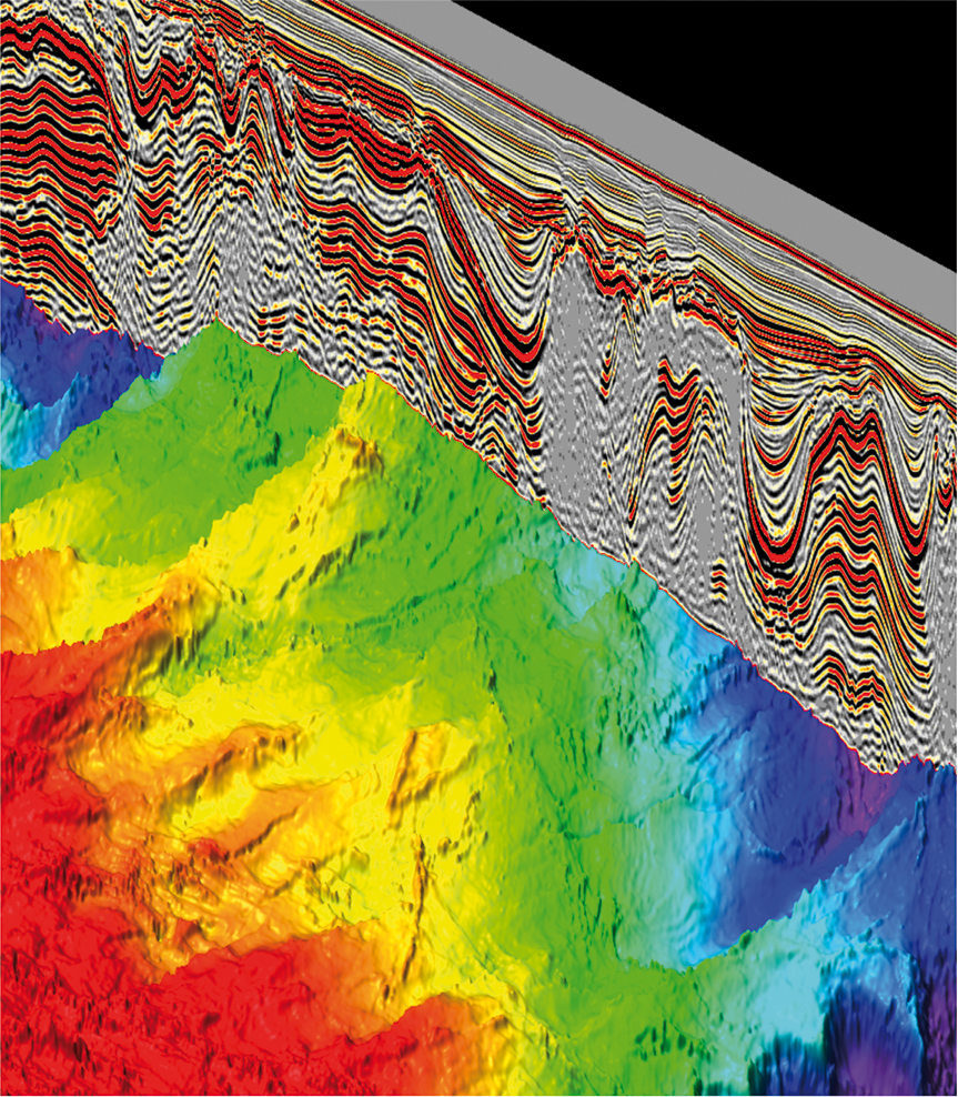
Subsurface image – Courtesy CGG
Seismic data can be acquired on land and on water. Although the equipment used is different, the principle stays the same. An acoustic source and a receiver are placed on the surface. The source is released and a wave of acoustic energy travels through the earth. The energy that comes back (reflected) is recorded at the receiver. The process is repeated at many different locations and the differences in traveltime are translated into an image in many complex processing steps after the end of the acquisition.
To make it more efficient, the number of receivers is increased to record the “echo” at many different places at the same time.
A reflection (“echo”) is caused by an change in the elastic properties of the subsurface. Any change in these properties will create an acoustic contrast which causes the wave to reflect some part of its energy while the rest of the energy is transmitted further into the earth.
Marine acquisition
Seismic acquisition on water is very efficient and cost effective compared to land acquisition. The reason for that is that the whole equipment is towed behind a ship which can move around relatively freely. Typically, several long cables filled with seismic receivers are towed behind the ship in a pattern. These streamers are typically 100m apart and many kilometers long. Industry standard nowadays is 6-8km for a typical acquisition. In some cases ultra-long cables of 12km (and up to 18km) are used.
The acoustic source is compressed air that is released by a device fittingly dubbed an “airgun”. Such an airgun is fired in regular intervals while the ship is moving.
Have a look the youtube video here to see what it looks like under water.
[youtube https://www.youtube.com/watch?v=FYiawvyh1O0?start=65]
It is a controversial tool because it creates a lot of noise within the water which could potentially distract or damage the hearing of marine mammals. That is why the major seismic companies employ marine mammal observers who have the authority to shut down operations if a mammal comes to close to the source.
The receivers in the streamers are evenly spaced, typically every 12.5m. The streamers are towed next to each other and are kept in position by a dynamic steering system called birds. Basically small wings that can be steered remotely to move the streamer around. An even sampling of the subsurface is desired.
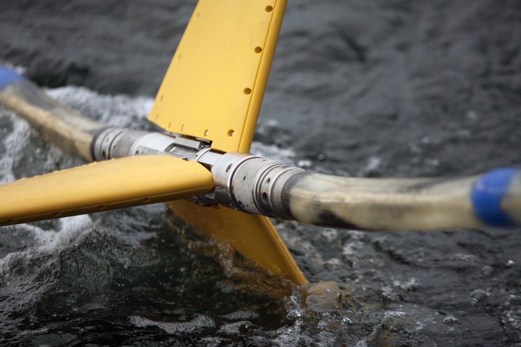
Bird on a seismic streamer – Courtesy Kongsberg Maritime.
Land acquisition
Terrestrial acquisition varies from marine acquisition in the used equipment. The overall principle is the same.
Instead of airguns, the used sources are vibrotrucks. They put out a continuous signal instead of a short burst of energy. The vibrotrucks start with a low frequency and increase it continuously. One, so-called sweep, lasts typically 10s. Since the signal is not a short burst, the recorded signals overlap and need to be separated. By cross-correlating the recorded signal with the used sweep (the so-called pilot signal)
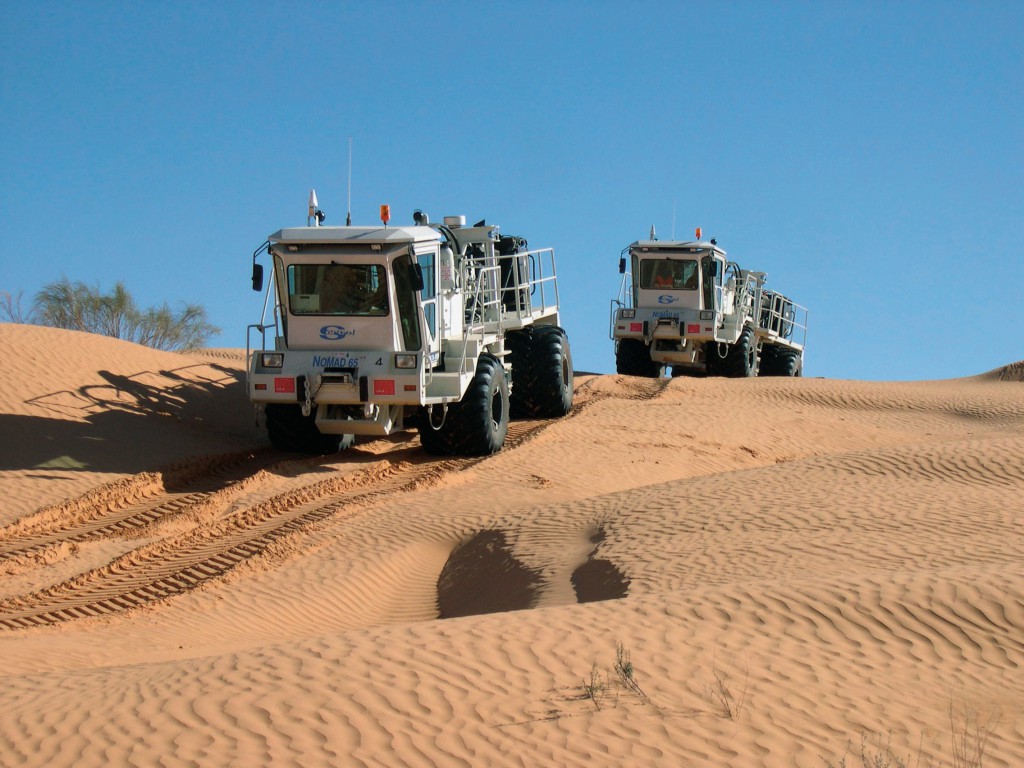
Vibroseis trucks in the desert – Courtesy of CGG
Several trucks are typically linked together to increase the output energy. While operations, the trucks drive around from shot point to shot point.
Instead of hydrophone in streamers, land-geophones are used. They record 3 components instead of just one because this allows to record the polarization of shear waves which are transported by the hard rock. S-Waves are filtered away by the water in marine acquisitions since water can not transport shear waves.
Putting out the geophones and recording equipment requires a lot of wiring and manual labor. This makes land acquisition typically slower and less cost-effective than marine.
On top, vegetation, streets, houses etc. are obstacles that can not be easily avoided. Months of planning and preparations have to be invested before single shot is fired in a land acquisition.
Check out the video to see them in action in the Kuwait desert.
[youtube https://www.youtube.com/watch?v=LB3wmFH525k]
Next up: Exploration Seismics 101 – Gathers and stacked images
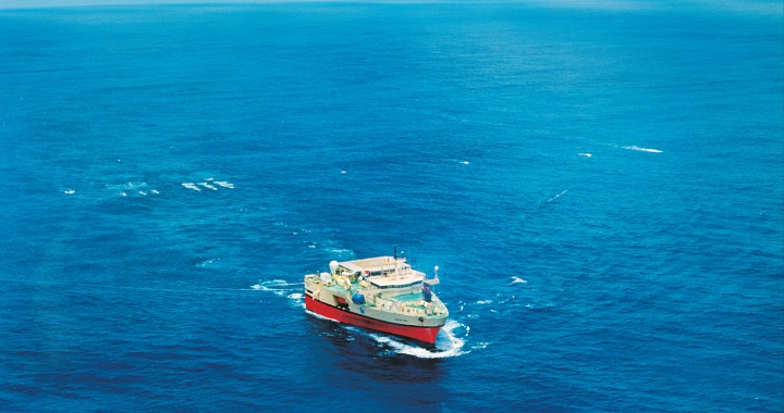
Featured image (top image) courtesy PGS.